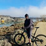
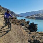
Queenstown & surrounds provide a smorgasbord of great cycle trails to suit all abilities. We have kindly compiled information on all of the most popular trails for your convenience, find a trail below to learn more.
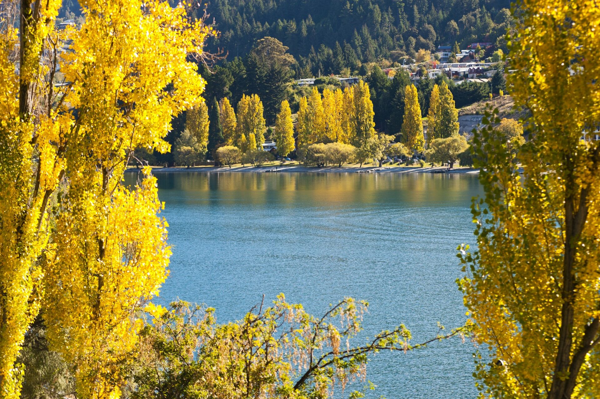
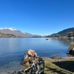
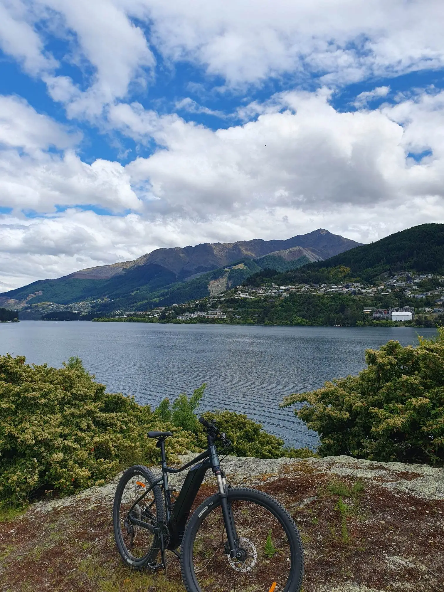
Starting from the Queenstown Gardens follow the easy trail around the edge of the Gardens and take in the scenery across the lake towards Walter Peak and up heading towards Glenorchy.
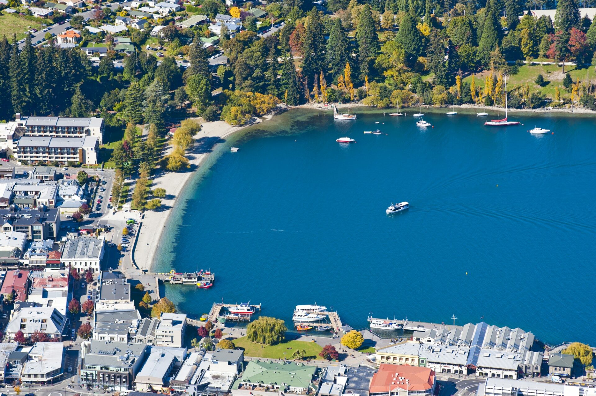
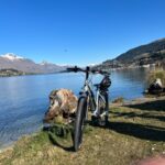
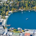
The trail turns around the end of the Gardens and you follow Lake Wakatipu down the Frankton Arm towards Frankton Marina and Beach. This is a nice gentle trail with great scenery the entire way.
At the Frankton Marina be sure to stop for coffee, morning tea or lunch at the Boatshed Café. Alternatively, if you feel like a beer, try Altitude Craft Brewery on the left side of the Marina carpark.
There is then a short distance to Frankton Beach. A little further from here you can view the historic Kawerau Falls Bridge (which is now part of the cycle trail network).
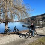
If you feel like adventuring further try the Kelvin Peninsula Trail which continues past the Hilton Hotel (great for pizza, wine, coffee or other beverages) right on the lakefront and you can park your bike right outside.
A popular trail for walkers and cyclists with mostly wide trails for both to enjoy.
Follow the trail around through Frankton Beach and up to the historic Kawerau Falls Bridge. Take the time to stop and take in the flow of the water under the bridge, the magnificent blue heughs are stunning. Follow the trail down past the Hilton Hotel (great spot for coffee, wine or pizza) right on the water front and park your bike outside.
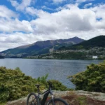
The trail then continues along the Frankton Arm passing several jetties and private homes until you come to Kelvin Grove and Queenstown Yacht Club.
Stop at one of the lakeside seats to take in the view of Lake Wakatipu or bring your togs for a swim.
This trail can continue on the Kelvin Heights Sculpture Trail.
This is a quick loop trail which has additional art pieces which were gifted by an anonymous benefactor. The track can be ridden in either direction but we recommended starting at the Kelvin Peninsula Beach and riding along the lake edge beside the golf course.
The first of four sculptures then appears – Wakatipu Kuikui by artist Mark Hill – wild hair blowing into the wind. Continue on the track and into the forest.
The second sculpture a kinetic sculpture by Arrowtown artist Shane Woolridge named Thru Link to Peak and in constructed of 25 tonnes of schist and perfectly frames Walter Peak on the far side of the lake.
The third sculpture to come into view is known as the Kelvin Peninsula Goats by Auckland artist Jeff Thompson.
The Queenstown Golf Club has a great café and is a short distance from the trail.
The last sculpture is by local artist Mark Hill and is known as Presence – said to depict a trees spirit. It can be easily missed as it blends into the surroundings really well.
This trail is great added to the Kelvin Peninsula Trail.
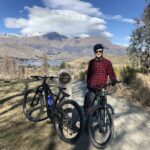
Starting from the South end of the Old Historic Lower Shotover Bridge the trail rises gently up the Arrow irrigation pipeline and follows the left-hand side of the Shotover River heading out towards Tuckers Beach. The trail is gentle and passes through the Wildlife Management Reserve (home to some rare birds including the banded Dotterel and Black fronted Tern) with Coronet Peak appearing in the distance. The end of this trail will bring you up close and personal with the Shotover River where you may even see the Shotover Jetboat passing by (another possible photo opportunity).
For the return ride, you can either come back along the same trail or alternatively ride back along the Tucker Beach Road (remember road rules apply if you come back this way).
You can start this trail from the Kawarau Suspension Bungy Bridge or you are continuing from completing the Arrow River Bridges Trail – whichever way, you won’t be disappointed.
As you head into the Gibbston Valley, famous for its wineries, the Kawerau River flows with you downstream as you head towards several wineries – the first can be accessed by crossing the highway to your right and into the Gibbston Valley Winery & Restaurant.
Alternatively keep riding and you will come to the Peregrine Winery, well worth a stop here. Continue on to Coalpit Road and across the highway to the Gibbston Tavern. Continue on from here to Mt Rosa Winery or Bennan Wines.
Whichever destination you decide to stop at, enjoy the wine, the cheeseboard and sunshine. Just call or text us and we can pick you up and bring you back to your accommodation – no need to worry about cycling back.
This trail starts at the Kawarau Falls Bridge where you can take in the vista of the river below before setting off on your ride.
The trail rides down from here and along the side of the Kawarau River – picturesque in itself with the trees along the shoreline. You will ride through the area known as the Shotover Delta where you may even see the Kawarau Jet blast past with a full boat of tourists who wave out as they pass.
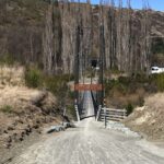
After passing under the main highway you will come to the Old Lower Shotover Bridge showing its history with information of its glorious past. Both Remarkables and Coronet Peak are visible from either side of the bridge.
After crossing the bridge follow the trail down to your right, you are now on the opposite side of the river. The trail goes onto the Old School Road and then down into Shotover Country and follows around the back of the subdivision and continues along the river side.
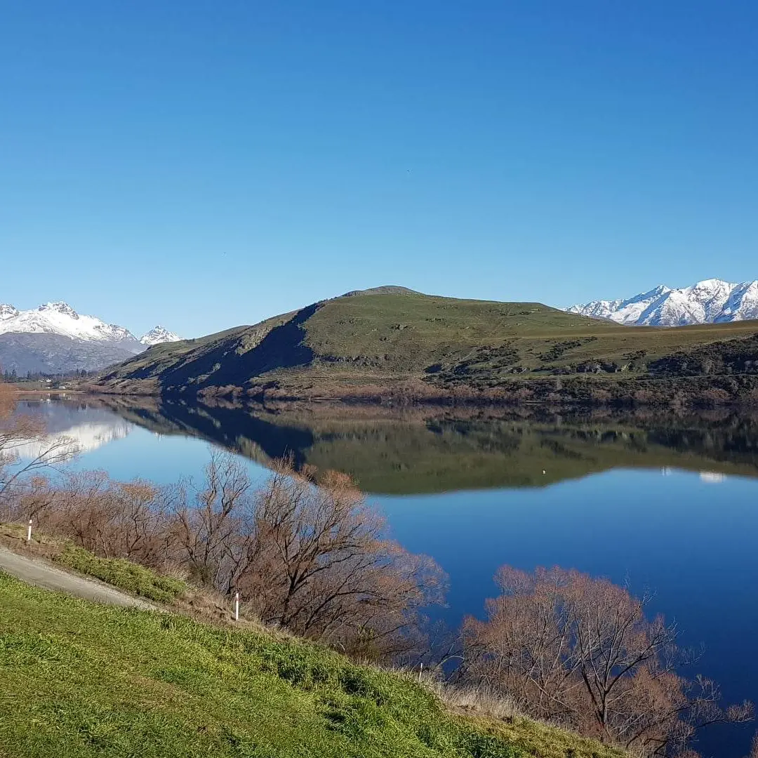
You will then go over the hill and past Lake Hayes Estate and then takes a rise up where you will be able to view both directions of the river again from the higher vantage points. The Kawarau River provides glorious colours of aqua blue.
Then take on the steady climb (remember you are riding an e-bike with assist) to the top of Thompson’s Hill. There is a seat at the top for a well deserved break and water stop.
There is then a gentle decline through farmland, still picturesque for an amazing view before the trail ends at Morven Ferry Road.
If you feel like continuing riding – you can join the Arrow River Bridges Trail and ride through to Arrowtown OR continue riding to Gibbston Valley and stop to enjoy some wine tasting or lunch.
Starting the trail from the heart of Arrowtown itself, ride alongside the gorgeous Arrow River. As you watch the river you head in the same direction watching the colour transformation and admiring its beauty. Along with the Arrow River, the countryside shows all its variances with majestic mountain views in all directions.
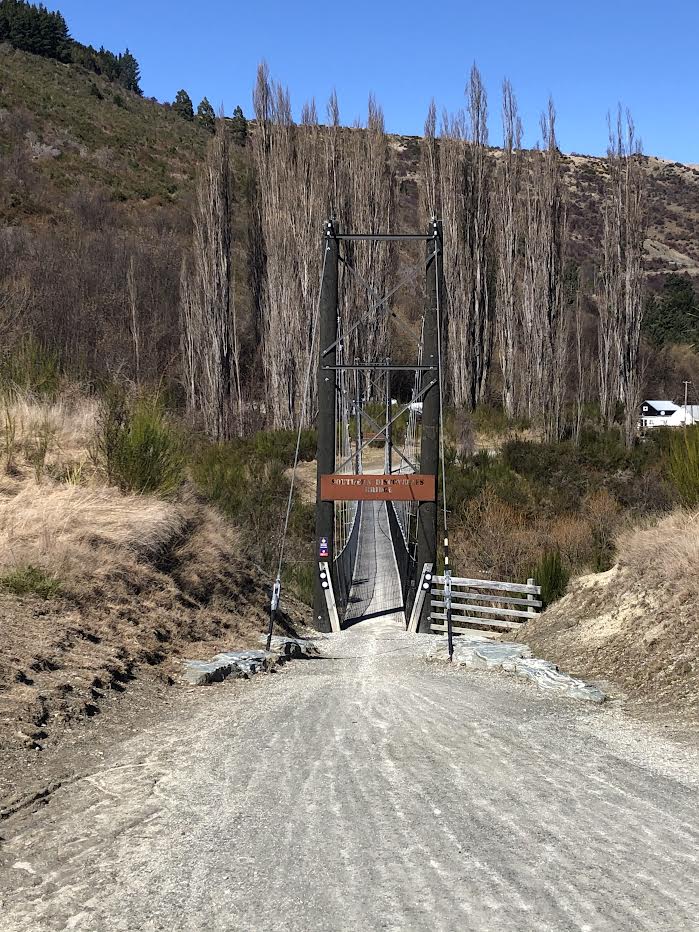
This trail will take you over five bridges as you head out towards Gibbston. Most of these bridges are stunning and give great photo opportunities to remember the ride for years to come.
There is no shortage of amazing scenery to be had including the Edgar Suspension Bridge which is 80 metres long and gives you views of the Gorge below. There is still plenty to see on the trail as you continue going under the main highway through a cleverly designed tunnel that then continues on to the Kawarau Suspension Bungy Bridge where if you are lucky, you will get to see someone take the bungy – it could even be you! It could be time for a stop here with a Café and toilets available.
You can be collected by shuttle from this point or continue on to one of the Gibbston Valley Wineries on the Gibbston River Trail.
This track is one of the most popular trails for both cyclists and walkers/runners. Taking approximately one hour to complete the circuit. There are bench seats along the way to take in the sight seeing vantage points and on a good still day, the trail lives up to its name and the reflection in the lake shows off the majestic mountain scenery.
There are two lots of toilets available on this trial at either end of the trail and several starting points available – for both drop off or pick up collection points if you require this service.
On a beautiful summers day you take your togs and stop off for a swim in the lake.
Starting from the Old Historic Lower Shotover Bridge, take some time to read the history on the side of the bridge. You can join this trail to other parts of the Queenstown Trail or ride this section itself.
Riding off from the old bridge you start alongside the Shotover River gently following an easy trail. Be prepared for the sharp incline up the hill (made easier on an e-bike) towards Dalefield.
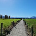
You will continue through green pastures sighting some stunning housing developments along the way.
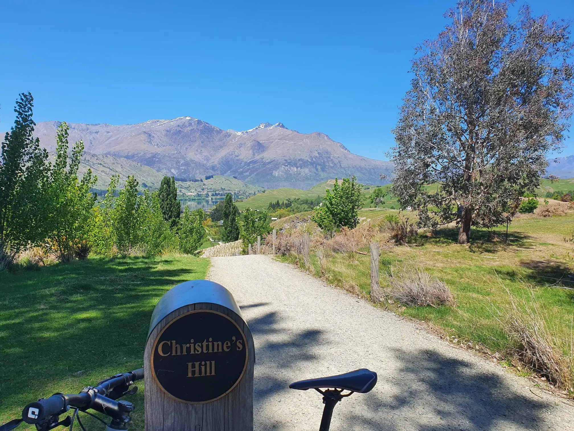
This trail does utilise some country roads (so please ensure you ride on the left side and follow the road rules). Continuing on this trail you will start the incline up Christine’s Hill – once again utilise your e-bike to make the hill more enjoyable. Make sure you stop at the top, turn around and take in the view looking across the landscape with Lake Hayes in the foreground. A great photo opportunity here with the Remarkables as the backdrop.
From here you will ride through the Millbrook Resort taking in the golfing mecca. There is a café in Millbrook if you feel like some refreshments or continue on the cycleway to Arrowtown.
From here you can join on the Arrow River Bridges Track or contact us for collection from Arrowtown.
The Dunstan trail is between Cromwell and Clyde alongside Lake Dunstan, the Kawarau River and Cromwell Gorge. It can be ridden in either direction but most ride from Cromwell to Clyde.
The official start of the trail is from Cromwell Heritage Precinct which makes the distance to Clyde 42km.
Alternatively, the full trail starts from Smiths Way, Mount Pisa if you wish to ride the entire 55km.
You can also start from Bannockburn Inlet which makes a total distance to Clyde of 34km.
The trail consists of dirt tracks, wooden boardwalks and gravel trails. The Dunstan trail shows off it’s pioneering and gold mining history and includes an 86m long, 29m high Hugo Suspension Bridge.
Along the trail you will find a floating café and lounge bar, just before Cairnmuir Gully to stop for refreshments.
At the end of the trail you can view New Zealand’s largest concrete hydro dam, just before reaching Clyde.
The most challenging part of the trail is before reaching Clyde dam where the trail is only 1.5m wide in places and has some steep drop off areas.
Lake Dunstan Trail is the most amazing trail to ride with stunning scenery in every direction.
Let us hire you an e-bike and shuttle you to Cromwell to ride it for yourself.
This trail opened back in 2000 and follows the former railway between Clyde and Middlemarch. The trail can be ridden in either direction. Break the trail in easy to ride daily amounts and enjoy the hospitality and amazing places along the way. The trail has amazing history utilizing some amazing old bridges and tunnels spanning back over the last 85 years.
We can shuttle you to start at either end and collect you and bring you back to Queenstown when you have completed the trail.
Ride or walk alongside the powerful Clutha Mata-au River through a fertile valley, secluded gorge and into lush green farmland.
Open all year round, this 73 kilometre easy-grade trail passes through four settlements along the way – Roxburgh, Millers Flat, Beaumont and Lawrence – and can take between two and four days to complete.
Full of variety, the terrain is undulating, flat and meandering.
At your own pace – Grade 2 (easy)
Begin your journey at any point, doing as much or as little as you like, in either direction!
Information panels along the way showcase a rich heritage and the adventurers who travelled this way before…
The Roxburgh Gorge Trail is one of New Zealand’s most visually spectacular day rides. Stretching between Alexandra and Lake Roxburgh Hydro Dam the trail follows the Clutha Mata-au River past eroded bluffs and old gold workings set amidst willows, native shrubs and fragrant thyme.
Cycle or walk from Alexandra to Doctors Point and then back again, or start from Lake Roxburgh Dam and head upstream to Shingle Creek and return. Experiencing the whole trail, you will enjoy a boat transfer between Doctors Point and Shingle Creek.
The colour palette is amazing! In late spring, the hillsides are covered in purple with flowering wild thyme, in summer the blue green of the Clutha River is in graphic contrast to the grey schist rock outcrops and in autumn the willow trees on the waters edge turn brilliant gold.
Open all year round, the trail is a well-formed 2.5 metre wide gravel surface with some climbs. It will take up to four or five hours to complete depending on how you choose to experience it. The trail’s proximity to the Otago Central Rail Trail and the Clutha Gold Trail will also ensure that visitors to the area will have the opportunity to experience even more of Central Otago’s unique scenery.


")